File:Australia discoveries by Europeans before 1813 de.png
Jump to navigation
Jump to search
Size of this preview: 651 × 599 pixels. Other resolutions: 261 × 240 pixels | 521 × 480 pixels | 834 × 768 pixels | 1,200 × 1,105 pixels.
Original file (1,200 × 1,105 pixels, file size: 1.47 MB, MIME type: image/png)
Captions
Captions
Add a one-line explanation of what this file represents
Summary[edit]
| Description |
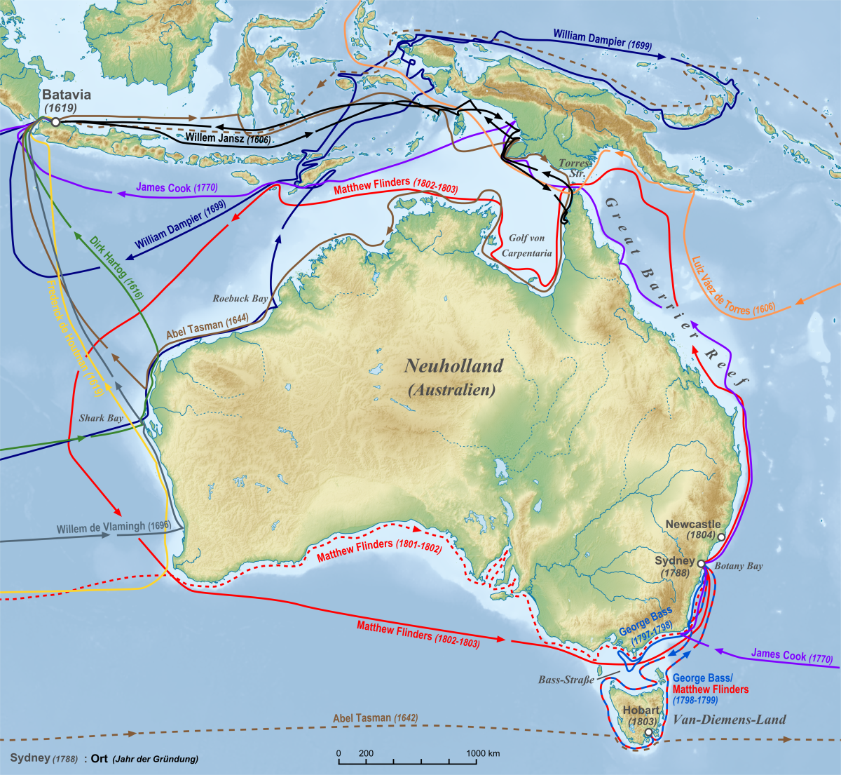
Deutsch: Karte der Routen europäischer Seefahrer zur Entdeckung Australiens in den Jahren vor 1813
Entdeckungen in chronologischer Abfolge: 1606 Willem Jansz
1606 Luiz Váez de Torres
1616 Dirk Hartog
1619 Frederick de Houtman
1644 Abel Tasman
1696 Willem de Vlamingh
1699 William Dampier
1770 James Cook
1797-1799 George Bass
1801-1803 Matthew Flinders |
| Date | |
| Source |
"own work", used:
|
| Author | Lencer |
| Other versions |
  |

|
This map has been made or improved in the German Kartenwerkstatt (Map Lab). You can propose maps to improve as well.
|
Licensing[edit]
This file is licensed under the Creative Commons Attribution-Share Alike 3.0 Unported license.
- You are free:
- to share – to copy, distribute and transmit the work
- to remix – to adapt the work
- Under the following conditions:
- attribution – You must give appropriate credit, provide a link to the license, and indicate if changes were made. You may do so in any reasonable manner, but not in any way that suggests the licensor endorses you or your use.
- share alike – If you remix, transform, or build upon the material, you must distribute your contributions under the same or compatible license as the original.
File history
Click on a date/time to view the file as it appeared at that time.
| Date/Time | Thumbnail | Dimensions | User | Comment | |
|---|---|---|---|---|---|
| current | 05:39, 11 October 2010 | | 1,200 × 1,105 (1.47 MB) | Lencer (talk | contribs) | small fix |
| 11:47, 1 October 2010 |  | 1,200 × 1,105 (1.47 MB) | Lencer (talk | contribs) | small fix | |
| 11:20, 29 September 2010 |  | 1,200 × 1,106 (1.46 MB) | Lencer (talk | contribs) | {{Information |Description= {{de|Karte der Routen europäischer Seefahrer zur Entdeckung Australiens in den Jahren vor 1813}} |Source="own work", used: * [[:de:Generic Mapping Tools|Generic Mapping Too |
You cannot overwrite this file.
File usage on Commons
The following 3 pages use this file:
File usage on other wikis
The following other wikis use this file:
- Usage on af.wikipedia.org
- Usage on bg.wikipedia.org
- Usage on cs.wikipedia.org
- Usage on de.wikipedia.org
- Geschichte Australiens
- Australien (Kontinent)
- Matthew Flinders
- Besiedlung Tasmaniens durch Weiße
- Geschichte Ozeaniens
- Australien
- Europäische Expansion
- Benutzer:Lencer
- Liste der europäischen Entdecker Australiens
- Wikipedia:Kartenwerkstatt/Archiv/2010-10
- Investigator (Schiff, 1795)
- Wikipedia:Kartenwerkstatt/Karte des Tages/Galerie
- Benutzer:Casadopovo/VISUALISIERUNG THERMODYNAMISCHER SYSTEME
- Küste von Western Australia
- Wikipedia:Kartenwerkstatt/Archiv/2021-12
- Usage on fr.wikipedia.org
- Usage on nn.wikipedia.org
- Usage on rm.wikipedia.org