File:Almsee Westufer-4154.jpg
Original file (4,524 × 2,545 pixels, file size: 3.12 MB, MIME type: image/jpeg)
Captions
Summary[edit]
DescriptionAlmsee Westufer-4154.jpg |
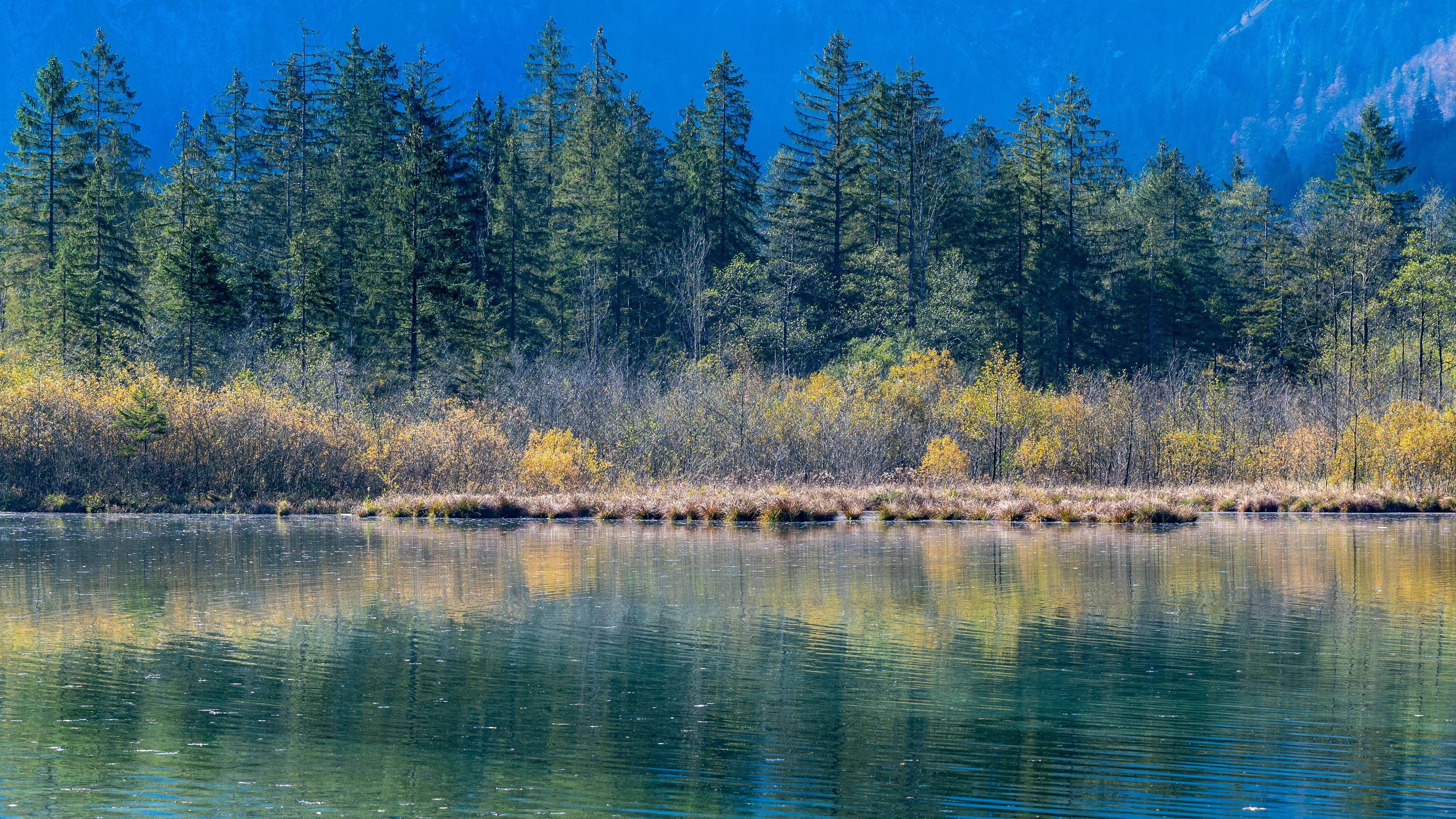
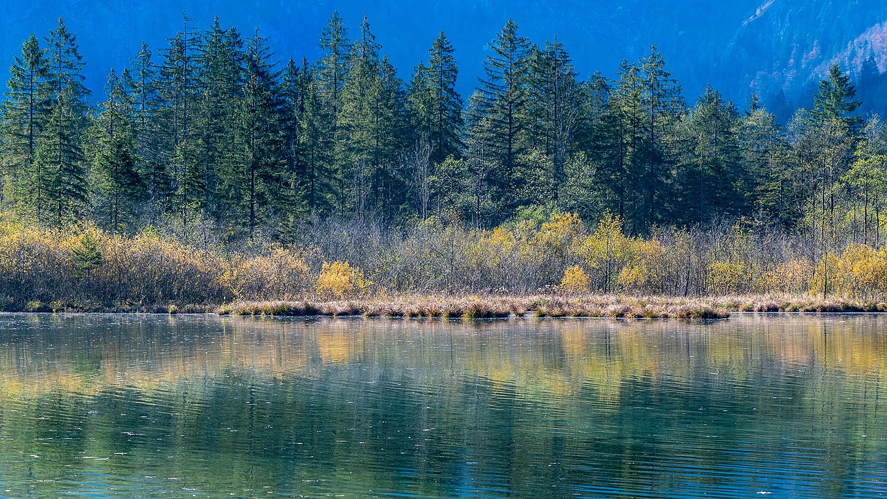
Deutsch: Der Almsee ist ein Alpensee mit überwiegend natürlichen Ufern und inselartigen Verlandungen.
English: The lake "Almsee" is an alpine lake with mostly natural lakesides and insular silting zones.
|
Date | |
Source | Own work |
Author | Isiwal |
Camera location | 47° 44′ 50.8″ N, 13° 57′ 33.23″ E | View this and other nearby images on: OpenStreetMap | 47.747445; 13.959230 |
---|
Licensing[edit]
- You are free:
- to share – to copy, distribute and transmit the work
- to remix – to adapt the work
- Under the following conditions:
- attribution – You must give appropriate credit, provide a link to the license, and indicate if changes were made. You may do so in any reasonable manner, but not in any way that suggests the licensor endorses you or your use.
- share alike – If you remix, transform, or build upon the material, you must distribute your contributions under the same or compatible license as the original.
Diese Datei wurde im Rahmen von WikiDaheim 2019 in Österreich erstellt und hochgeladen. Sie wurde dem Themenbereich Naturschutz zugeordnet. |
This image has been assessed using the Quality image guidelines and is considered a Quality image.
العربية ∙ جازايرية ∙ беларуская ∙ беларуская (тарашкевіца) ∙ български ∙ বাংলা ∙ català ∙ čeština ∙ Cymraeg ∙ Deutsch ∙ Schweizer Hochdeutsch ∙ Zazaki ∙ Ελληνικά ∙ English ∙ Esperanto ∙ español ∙ eesti ∙ euskara ∙ فارسی ∙ suomi ∙ français ∙ galego ∙ עברית ∙ हिन्दी ∙ hrvatski ∙ magyar ∙ հայերեն ∙ Bahasa Indonesia ∙ italiano ∙ 日本語 ∙ Jawa ∙ ქართული ∙ 한국어 ∙ kurdî ∙ Lëtzebuergesch ∙ lietuvių ∙ македонски ∙ മലയാളം ∙ मराठी ∙ Bahasa Melayu ∙ Nederlands ∙ Norfuk / Pitkern ∙ polski ∙ português ∙ português do Brasil ∙ rumantsch ∙ română ∙ русский ∙ sicilianu ∙ slovenčina ∙ slovenščina ∙ shqip ∙ српски / srpski ∙ svenska ∙ தமிழ் ∙ తెలుగు ∙ ไทย ∙ Tagalog ∙ Türkçe ∙ toki pona ∙ українська ∙ vèneto ∙ Tiếng Việt ∙ 中文 ∙ 中文(简体) ∙ 中文(繁體) ∙ +/− |
File history
Click on a date/time to view the file as it appeared at that time.
Date/Time | Thumbnail | Dimensions | User | Comment | |
---|---|---|---|---|---|
current | 18:38, 18 July 2019 | 4,524 × 2,545 (3.12 MB) | Isiwal (talk | contribs) | User created page with UploadWizard |
You cannot overwrite this file.
File usage on Commons
The following 3 pages use this file:
Metadata
This file contains additional information such as Exif metadata which may have been added by the digital camera, scanner, or software program used to create or digitize it. If the file has been modified from its original state, some details such as the timestamp may not fully reflect those of the original file. The timestamp is only as accurate as the clock in the camera, and it may be completely wrong.
Camera manufacturer | NIKON CORPORATION |
---|---|
Camera model | NIKON D500 |
Exposure time | 1/60 sec (0.016666666666667) |
F-number | f/8 |
ISO speed rating | 100 |
Date and time of data generation | 12:16, 18 October 2018 |
Lens focal length | 70 mm |
Latitude | 47° 44′ 50.8″ N |
Longitude | 13° 57′ 33.23″ E |
Altitude | 580 meters above sea level |
Horizontal resolution | 120 dpi |
Vertical resolution | 120 dpi |
Software used | Adobe Photoshop Lightroom Classic 8.0 (Windows) |
File change date and time | 18:03, 18 October 2018 |
Exposure Program | Aperture priority |
Exif version | 2.3 |
Date and time of digitizing | 12:16, 18 October 2018 |
APEX shutter speed | 5.906891 |
APEX aperture | 6 |
APEX exposure bias | 0 |
Maximum land aperture | 3 APEX (f/2.83) |
Metering mode | Pattern |
Light source | Unknown |
Flash | Flash did not fire |
DateTimeOriginal subseconds | 45 |
DateTimeDigitized subseconds | 45 |
Color space | sRGB |
Focal plane X resolution | 2,360.8599243164 |
Focal plane Y resolution | 2,360.8599243164 |
Focal plane resolution unit | 3 |
Sensing method | One-chip color area sensor |
File source | Digital still camera |
Scene type | A directly photographed image |
Custom image processing | Normal process |
Exposure mode | Auto exposure |
White balance | Auto white balance |
Focal length in 35 mm film | 105 mm |
Scene capture type | Landscape |
Scene control | None |
Contrast | Normal |
Saturation | Normal |
Sharpness | Normal |
Subject distance range | Unknown |
GPS tag version | 0.0.2.2 |
IIM version | 4 |
Structured data
47°44'50.802"N, 13°57'33.228"E
18 October 2018
0.01666666666666666666 second
70 millimetre
100
image/jpeg
06f6e213d4253264b030053050185d176d07c6ac
3,269,010 byte
2,545 pixel
4,524 pixel
- Nature reserves in Austria with known ID
- Files with coordinates missing SDC location of creation
- CC-BY-SA-4.0
- Self-published work
- Media from WikiDaheim 2019 in Austria/all
- Media from WikiDaheim 2019 in Austria/Natural heritage
- Quality images
- Nature reserves in Austria needing check
- Uploaded via Campaign:wle-at-nsg
- Quality images of Upper Austria
- Quality images by Isiwal
- Quality images supported by Wikimedia Österreich in 2019
- Austria photographs taken on 2018-10-18
- Quality images of nature
- Pages with maps