File:2019 Osttirol 1009 Helmhaus.jpg
Jump to navigation
Jump to search

Size of this preview: 800 × 450 pixels. Other resolutions: 320 × 180 pixels | 640 × 360 pixels | 1,024 × 576 pixels | 1,280 × 720 pixels | 2,560 × 1,440 pixels | 4,032 × 2,268 pixels.
Original file (4,032 × 2,268 pixels, file size: 7.46 MB, MIME type: image/jpeg)
Captions
Captions
Add a one-line explanation of what this file represents
Summary[edit]
| Description |
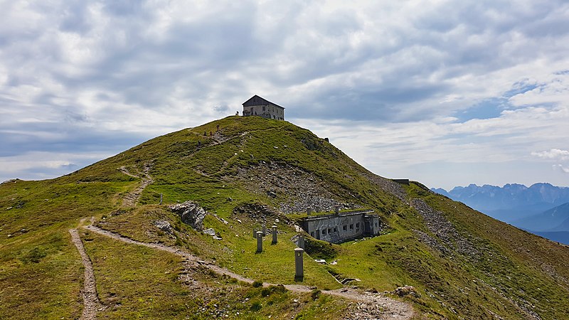
English: Mountain Helm with the ruin of the Helm hut and bunkers from the World War One (Carnic Alps)
Deutsch: Helm-Gipfel mit Ruine der Helmhütte und Bunkeranlagen des Ersten Weltkrieges (Karnische Alpen)
Italiano: Monte Elmo con le rovine dell'Helmhütte e sistemi di bunker della prima guerra mondiale (Alpi Carniche) |
| Date | |
| Source | Own work |
| Author | Steffen 962 |
| Camera location | | View this and other nearby images on: OpenStreetMap |
|---|
Licensing[edit]
I, the copyright holder of this work, hereby publish it under the following license:
This file is licensed under the Creative Commons Attribution-Share Alike 4.0 International license.
- You are free:
- to share – to copy, distribute and transmit the work
- to remix – to adapt the work
- Under the following conditions:
- attribution – You must give appropriate credit, provide a link to the license, and indicate if changes were made. You may do so in any reasonable manner, but not in any way that suggests the licensor endorses you or your use.
- share alike – If you remix, transform, or build upon the material, you must distribute your contributions under the same or compatible license as the original.
File history
Click on a date/time to view the file as it appeared at that time.
| Date/Time | Thumbnail | Dimensions | User | Comment | |
|---|---|---|---|---|---|
| current | 22:13, 23 May 2020 | | 4,032 × 2,268 (7.46 MB) | Steffen 962 (talk | contribs) | Color correction with Luminar 2018 |
| 01:30, 5 January 2020 |  | 4,032 × 2,268 (3.1 MB) | Steffen 962 (talk | contribs) | {{Information |description ={{en|1=Mountain Helm with the ruin of the Helm hut and bunkers from the World War One (Carnic Alps)}} {{de|1=Helm-Gipfel mit Ruine der Helmhütte und Bunkeranlagen des Ersten Weltkrieges (Karnische Alpen)}} {{it|1=Monte Elmo con le rovine dell'Helmhütte e sistemi di bunker della prima guerra mondiale (Alpi Carniche)}} |date =2019-07-21 |source ={{own}} |author =User:Steffen 962 }} Category:Helm (mountain) |
You cannot overwrite this file.
File usage on Commons
The following 7 pages use this file:
- User:Anton-kurt/Tyrol new files/2020 January 1-10
- User:Anton-kurt/Tyrol new files/2020 May 21-31
- User:Mai-Sachme/South Tyrol/2020 January 1-10
- User:Mai-Sachme/South Tyrol/2020 May 21-31
- Commons:Photo challenge/2020 - January - Rural decay
- Commons:Photo challenge/2020 - January - Rural decay/Voting
- Commons:Photo challenge/2020 - January - Rural decay/Voting/Result
File usage on other wikis
The following other wikis use this file:
- Usage on cs.wikipedia.org
- Usage on de.wikipedia.org