File:20161001 Sydney Harbour & Queen Mary 2.jpg
Jump to navigation
Jump to search

Size of this preview: 800 × 533 pixels. Other resolutions: 320 × 213 pixels | 640 × 427 pixels | 1,024 × 683 pixels | 1,280 × 853 pixels | 2,560 × 1,707 pixels | 3,888 × 2,592 pixels.
Original file (3,888 × 2,592 pixels, file size: 4.9 MB, MIME type: image/jpeg)
Captions
Captions
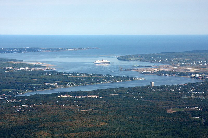
The RMS Queen Mary 2 visiting Sydney Harbour, Cape Breton Island on October 1st, 2016.
Summary[edit]
| Description |
English: The RMS Queen Mary 2 visiting Sydney, Cape Breton Island on October 1st, 2016. RMS Queen Mary 2 is the flagship of Cunard Line and is one of the larges cruise ships in the world.She is an Ocean Liner, built for crossing the Atlantic Ocean, though she is regularly used for cruising; in the winter season she cruises from New York to the Caribbean on twelve- or thirteen-day tours. |
| Date | |
| Source | Own work |
| Author | Ken Heaton |
| Camera location | | View this and other nearby images on: OpenStreetMap |
|---|
Licensing[edit]
I, the copyright holder of this work, hereby publish it under the following license:
This file is licensed under the Creative Commons Attribution-Share Alike 4.0 International license.
- You are free:
- to share – to copy, distribute and transmit the work
- to remix – to adapt the work
- Under the following conditions:
- attribution – You must give appropriate credit, provide a link to the license, and indicate if changes were made. You may do so in any reasonable manner, but not in any way that suggests the licensor endorses you or your use.
- share alike – If you remix, transform, or build upon the material, you must distribute your contributions under the same or compatible license as the original.
File history
Click on a date/time to view the file as it appeared at that time.
| Date/Time | Thumbnail | Dimensions | User | Comment | |
|---|---|---|---|---|---|
| current | 15:03, 10 April 2020 | | 3,888 × 2,592 (4.9 MB) | Ken Heaton (talk | contribs) | Uploaded own work with UploadWizard |
You cannot overwrite this file.
File usage on Commons
The following page uses this file:
File usage on other wikis
The following other wikis use this file:
- Usage on en.wikipedia.org
- Usage on uk.wikipedia.org
Metadata
Categories:
- Cape Breton Regional Municipality
- Cape Breton Island
- October 2016 in Nova Scotia
- Queen Mary 2 (ship, 2003)
- Transport in Sydney, Nova Scotia
- Water transport in Cape Breton Regional Municipality
- Ports and harbours in Nova Scotia
- Atlantic Ocean
- Cruise ships in Nova Scotia
- 2016 aerial photographs of Canada
- Sydney, Nova Scotia