File:1851 chart of maritime flags of the world by Charles Copley.jpg
Jump to navigation
Jump to search

Size of this preview: 800 × 538 pixels. Other resolutions: 320 × 215 pixels | 640 × 430 pixels | 1,024 × 689 pixels | 1,280 × 861 pixels | 2,560 × 1,722 pixels | 8,394 × 5,646 pixels.
Original file (8,394 × 5,646 pixels, file size: 5.61 MB, MIME type: image/jpeg)
Captions
Captions
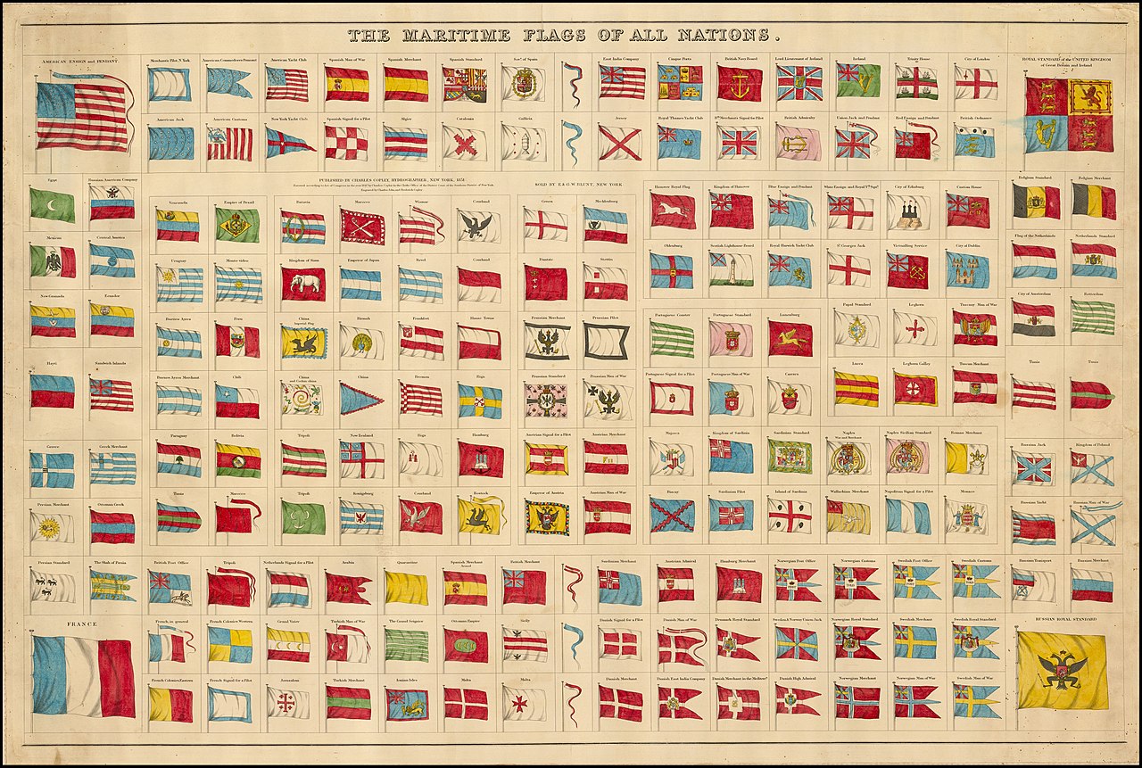
The Maritime Flags of All Nations.
Summary[edit]
| The Maritime Flags of All Nations | |
|---|---|
| Author |
Charles Copley |
| Title |
The Maritime Flags of All Nations |
| Description |
English: 1851 chart of maritime flags of the world by Charles Copley |
| Date | 1851 |
| Place of creation | New York, N.Y. |
| Source/Photographer | Barry Lawrence Ruderman Map Collection |
| Other versions | |
.jpg)
Licensing[edit]
|
This work is in the public domain in its country of origin and other countries and areas where the copyright term is the author's life plus 70 years or fewer. This work is in the public domain in the United States because it was published (or registered with the U.S. Copyright Office) before January 1, 1929. | |
| This file has been identified as being free of known restrictions under copyright law, including all related and neighboring rights. | |
File history
Click on a date/time to view the file as it appeared at that time.
| Date/Time | Thumbnail | Dimensions | User | Comment | |
|---|---|---|---|---|---|
| current | 02:37, 19 March 2021 | | 8,394 × 5,646 (5.61 MB) | Giro720 (talk | contribs) | larger version |
| 10:54, 22 March 2020 |  | 2,676 × 1,800 (907 KB) | Balkanique (talk | contribs) | Uploaded a work by Charles Copley from https://www.raremaps.com/gallery/detail/36184mb/the-maritime-flags-of-all-nations-copley with UploadWizard |
You cannot overwrite this file.
File usage on Commons
The following 3 pages use this file:
.jpg)